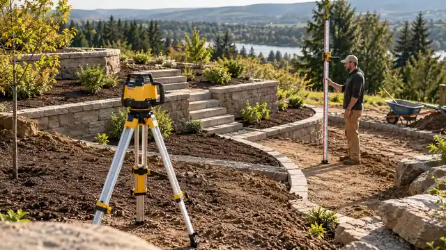
A garden can look almost flat from the back door and reveal a very different set of heights when you start measuring. Paths, beds, terrace edges, and existing hard surfaces need a common reference if the finished layout is going to make sense together. The best laser level for landscaping needs to connect each reading to a preserved reference, especially when the ground and light conditions change.
A rotary system helps compare those elevations around the work area. It does not choose the drainage route or decide which surfaces should be level. The receiver, rod, and benchmark turn the projected reference into useful measurements, especially when daylight makes a visible beam difficult to read.
These nine choices emphasize outdoor elevation transfer, complete equipment packages, and useful control options. Pick around the stages you will repeat: comparing existing ground, marking planned heights, and checking the prepared work. The best arrangement keeps those readings connected as the site changes.
Quick Answer
- Best Overall: Topcon RL-H5A Receiver Kit. Horizontal rotary reference.
- Best Complete Garden-to-Building Kit: Bosch GRL900-20HVK Kit. Horizontal and vertical rotary operation.
- Best for Repeated Numeric Offset Checks: Spectra Precision LL300N with HL450. Horizontal rotary reference.
Comparison Table
| Product | Best fit | Reference layout | Power and positioning |
|---|---|---|---|
| Topcon RL-H5A Receiver Kit | Best Overall | Horizontal rotary reference | Specified D-cell or rechargeable configuration; Receiver holder; tripod separate |
| Bosch GRL900-20HVK Kit | Best Complete Garden-to-Building Kit | Horizontal and vertical rotary operation | Selected alkaline-battery kit; LR10 receiver, BT160 tripod and grade rod |
| Spectra Precision LL300N with HL450 | Best for Repeated Numeric Offset Checks | Horizontal rotary reference | Four D-cell batteries; HL450 receiver and clamp; tripod separate |
| Spectra Precision LL100N-2 Kit | Best Included Inch-Based Field Setup | Horizontal rotary reference | Two D-cell batteries; Tripod, HR320 receiver and inch-graduated rod |
| Johnson Level 99-027K System | Best Complete Horizontal-Reference Alternative | Horizontal rotary; manual vertical alignment | Four C-cell batteries; Detector, tripod and 13-foot rod |
| Bosch GRL2000-40HVK Kit | Best Manual Dual-Slope Field Package | Horizontal/vertical rotary; manual dual slope | Battery-powered selected kit; Receiver, tripod, rod, remote and wall mount |
| Spectra Precision LL500 with HL700 | Best Deliberate Fixed Datum | Horizontal rotary reference | Four D-cell batteries; Three-screw base; HL700 receiver |
| Milwaukee M18 3701-21T System | Best Complete M18 Landscaping System | Red exterior horizontal rotary reference | M18 rechargeable platform; 3711 receiver, tripod and grade rod |
| Spectra Precision LL1505C-BCC | Best Connected Manual-Slope Option | Horizontal rotary with manual slope | NiMH selected package; documented alkaline alternative; Bluetooth app control; receiver separate |
1. Topcon RL-H5A Receiver Kit (Best Overall)

Paths, beds, and terrace edges can share a datum without sharing the same finished height. The RL-H5A supplies a horizontal rotary reference and receiver for those comparisons in daylight. Its focused role is keeping planned elevations related as the work moves around the garden.
Topcon specifies an 800-meter working diameter and ±10 arc-second horizontal accuracy for the RL-H5A. Electronic horizontal self-leveling and IP66 protection suit outdoor elevation work with a receiver. The selected listing identifies an LS-80L receiver and holder; verify the exact battery and support-equipment bundle. The advantage is a consistent measurement system rather than a beam that tells you what the landscape should become. Record a benchmark and identify the planned height at each station. A lower ground point can produce a larger rod reading, so keeping the measurement convention clear matters as much as choosing the transmitter.
Pros
- Horizontal rotary reference for elevation checks.
- Receiver and holder identified in the selected kit.
- Electronic self-leveling.
- Documented IP66 protection.
- Manual slope capability described by the manufacturer.
Cons
- Not a three-plane interior wall-layout tool.
- Tripod, rod, and exact battery bundle need separate confirmation.
A garden with several planned heights is a good reason to favor one dependable horizontal-reference routine. The RL-H5A can relate those positions without asking the operator to redefine the plane for every bed or path edge. Complete kits are more attractive when the support equipment is missing, while the LL300N offers a different receiver display experience. With a suitable tripod and rod arranged, the Topcon is most compelling for someone who wants outdoor height comparison to remain a focused, repeatable task.
To buy this product, click here.
2. Bosch GRL900-20HVK Kit (Best Complete Garden-to-Building Kit)

A landscape tied to existing building surfaces can give a mixed-use field kit a practical purpose. The GRL900-20HVK includes the receiver, tripod, and rod needed for outdoor elevation transfer. Its other mounting and rotary functions are relevant when the same equipment will also serve building layout.
The selected kit includes an LR10 receiver, tripod, grade rod, remote, wall mount, and case. Horizontal and vertical operation supports elevation transfer and interior alignment. Electronic leveling and a disturbance monitor help identify a changed setup; the linked package lists D-cell power for the transmitter. For a new path beside an existing patio, the useful step is connecting both to a preserved datum. Do not let a convenient form edge become the reference without checking what it represents. The disturbance monitor provides feedback, while returning to the benchmark confirms that the measured relationship has survived site activity.
Pros
- Horizontal and vertical operation.
- Electronic leveling.
- Disturbance monitor.
- Receiver, tripod, and rod included.
- Remote and wall mount supplied.
Cons
- Larger package than a compact wall laser.
- Do not assume numeric slope entry.
The GRL900-20HVK suits a buyer whose landscaping work also touches building references and who needs the full field arrangement assembled. Its value lies in those related roles and the included receiver, tripod, and rod, not simply in carrying more accessories. A dedicated height-transfer package may fit better when the other functions will stay unused. For a new measuring kit that must move between garden elevations and building layout, the Bosch provides a coherent set of tools for those defined jobs.
To buy this product, click here.
3. Spectra Precision LL300N with HL450 (Best for Repeated Numeric Offset Checks)

Numeric offset feedback can help organize repeated checks as existing ground becomes a prepared surface. The LL300N with HL450 supports that reading style in a protected rotary package. A stable transmitter position can then serve several defined stations without relying on a visible ground line.
The LL300N combines automatic horizontal leveling with a protective rotor housing and IP66 enclosure. The selected alkaline package includes an HL450 receiver and clamp but does not include a tripod. Its single-axis slope workflow requires the optional RC601 remote, with leveling retained on the other axis. The displayed offset is useful information within the receiver window, not a plan for where water should go. Keep the rod units and contact points consistent. Its optional single-axis slope workflow needs the specified remote, which should be part of the equipment plan if that method is important.
Pros
- Automatic horizontal leveling.
- IP66 enclosure.
- Protective rotor housing.
- HL450 receiver included.
- Optional single-axis slope workflow.
Cons
- Tripod and rod are separate in this package.
- RC601 remote is separate.
The LL300N is worth a closer look when repeated offset readings are central to the work. The HL450 can help describe the remaining difference at a station, while the rod and benchmark establish what that difference means for the landscape. Someone mainly missing a tripod and rod may find a complete system more immediately relevant. With those supports available, this Spectra combination makes sense for an operator who prefers a deliberate numerical reading routine as the site moves from existing ground to prepared surfaces.
To buy this product, click here.
4. Spectra Precision LL100N-2 Kit (Best Included Inch-Based Field Setup)

An inch-based landscape plan deserves a rod that fits the same convention. The LL100N-2 supplies that rod with a receiver and tripod. For a buyer assembling field equipment together, the coordinated reading arrangement is as important as the transmitter’s horizontal reference.
The LL100N automatically establishes a horizontal reference and provides a height-change alert. This LL100N-2 package includes an HR320 receiver, rod clamp, tripod, inch-graduated rod, and system case. Manual slope operation requires the appropriate optional RC601 remote; it is not a numeric dial-in grade laser. Use the same reference surface at each planned station, whether that is existing paving or a defined point on prepared ground. The package’s usefulness comes from consistency, not from making every garden component the same height. Optional slope operation needs the documented remote, while level-datum readings remain available as a separate method.
Pros
- Horizontal self-leveling.
- Height-change alert.
- HR320 receiver and clamp included.
- Tripod and inch-graduated rod included.
- System case organizes the selected package.
Cons
- Optional remote is needed for the documented slope workflow.
- Not a three-plane interior line laser.
The LL100N-2 is particularly well matched to an inch-based garden layout and a buyer assembling field equipment together. That match of rod, receiver, and units can be more useful than a feature that never enters the measurement routine. A different graduation system may call for another package or rod. For someone comfortable working in feet and inches, the supplied arrangement gives planned elevations a consistent reference, while the benchmark preserves that relationship as the garden changes around it.
To buy this product, click here.
5. Johnson Level 99-027K System (Best Complete Horizontal-Reference Alternative)
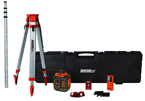
A stepped landscape can be measured through changing readings against one horizontal plane. The 99-027K supplies the field equipment for that method without adding slope adjustment. That gives the system a clear role for comparing planned terrace or bed elevations from a preserved datum.
The 99-027K self-levels horizontally and supports manual vertical alignment with a split beam. The system includes a detector and clamp, tripod, dual-graduated grade rod, batteries, target, and hard case. Its IP66 housing and locking compensator support site use and transport; this model does not provide slope adjustment. The absence of slope control makes the method important: represent the planned change through the rod reading instead of trying to tilt the instrument. The dual-graduated rod is convenient only when the correct face is used consistently. Label transitions so a step in the design is not confused with a moved datum.
Pros
- Detector, tripod, and rod included.
- Horizontal self-leveling.
- Dual rod graduations.
- IP66 enclosure.
- Locking compensator for transport.
Cons
- No slope-adjustment function.
- Vertical setup is manual.
Stepped beds and terrace marks do not automatically require a slope-capable laser. The Johnson system can relate their different intended heights to one horizontal datum through recorded offsets. That is its strongest landscaping role, supported by the included field equipment. A planned inclined-plane workflow points toward the GRL2000-40HVK instead. For a buyer who understands the level-reference method and wants a complete system for it, the Johnson offers a clear, purposeful alternative to adding slope controls that the layout does not need.
To buy this product, click here.
6. Bosch GRL2000-40HVK Kit (Best Manual Dual-Slope Field Package)

Changing the optical plane is useful only when it represents the intended landscape surface. The GRL2000-40HVK adds manual dual-axis adjustment to a complete field package. Its controls are relevant to a defined inclined-reference method rather than to uneven ground in general.
Manual dual-slope adjustment allows the reference angle to be changed on both axes. Electronic self-leveling and a disturbance monitor support repeatable site setup. The linked complete package includes a receiver, tripod, grade rod, remote, wall mount, and carrying case. Before using slope controls, establish the relevant start, end, and axis directions. A tilted reference that follows the wrong axis can be clear and repeatable while still being wrong for the plan. Manual adjustment is not numerical percentage entry, so choose the method you can verify at known points.
Pros
- Manual slope adjustment on two axes.
- Horizontal and vertical operation.
- Electronic self-leveling.
- Disturbance monitor.
- Receiver, tripod, rod, and remote included.
Cons
- Manual slope is different from automatic numeric grade entry.
- Complete kit takes more storage space than a line laser.
The Bosch’s manual dual-axis control is useful when the landscape plan genuinely calls for an inclined reference that can be checked at known points. It is less persuasive as a feature bought merely because the ground is uneven. Mixed terraces may be simpler to measure from a horizontal datum, while another surface may justify the slope method. The GRL2000-40HVK suits someone who can define that distinction in advance and will use its complete field equipment to verify the reference rather than only adjust it.
To buy this product, click here.
7. Spectra Precision LL500 with HL700 (Best Deliberate Fixed Datum)

A site with one stable measuring position can reward deliberate initial preparation. The LL500 pairs its horizontal reference with an HL700 receiver for repeated comparisons. It is a useful option when many stations can be checked while the instrument remains clear of the active work.
The LL500 uses a three-screw base and circular bubble for initial setup before its limited self-leveling compensation takes over. Its horizontal tolerance is specified at approximately ±1/16 inch at 100 feet. The selected package identifies an HL700 receiver, rod clamp, batteries, and case; tripod and rod are separate. The three-screw base requires deliberate preparation within its compensation range. Once established, keep the instrument clear of soft disturbed ground and movement around the tripod. The digital receiver can explain a difference from the beam, but a sound benchmark is what links that difference to the original garden layout.
Pros
- Dedicated horizontal elevation reference.
- Fine horizontal tolerance at a stated distance.
- HL700 receiver supplied in the selected package.
- Circular bubble and three-screw setup base.
- Replaceable D-cell supply.
Cons
- Initial setup is more manual than broad-range servo-leveling models.
- No automatic numeric grade entry.
The LL500 has a stronger case on a site where a carefully prepared measuring position can remain undisturbed. Its deliberate base setup and HL700 receiver fit repeated horizontal comparisons, especially when many stations need to remain related to one benchmark. Frequent moves may make another instrument routine more convenient. For a buyer planning a stable station outside excavation and material storage, the LL500 offers a focused way to keep those garden-height relationships measurable through successive stages of the work.
To buy this product, click here.
8. Milwaukee M18 3701-21T System (Best Complete M18 Landscaping System)

Shared battery power is only part of this Milwaukee package’s landscaping appeal. The supplied receiver, tripod, and rod give the M18 transmitter a complete field context. That arrangement is useful for repeated daylight readings at planned stations around a changing outdoor site.
The selected exterior system combines the red rotary transmitter with a 3711 receiver. Its linked package identifies an M18 battery, charger, receiver clamp, tripod, grade rod, and case. Masking shutters and selectable bump sensitivity support controlled setup; quoted field coverage is a diameter rather than a receiver radius. A clear site position still matters. Plants, stored materials, and a change in terrain can interrupt the path to the receiver. Preserve a transfer mark before relocating the instrument, and verify the original datum when returning. The complete package removes missing equipment from the plan, not the need for a consistent measurement routine.
Pros
- Compatible receiver supplied.
- Tripod and grade rod included.
- M18 battery and charger package.
- Masking shutters.
- Selectable bump sensitivity.
Cons
- No dual-slope control like the 3704 family.
- Large field system for a simple indoor wall mark.
This Milwaukee package is most relevant when an M18 user also needs the receiver and support equipment for outdoor measurements. Sharing the platform is convenient, but the coherent field arrangement is the stronger reason to shortlist it for landscaping. A smaller visible-line task does not need that whole system. For comparing outdoor stations across a changing site, the included equipment has a useful purpose when the tripod can stay clear and every new reading remains connected to the preserved datum.
To buy this product, click here.
9. Spectra Precision LL1505C-BCC (Best Connected Manual-Slope Option)
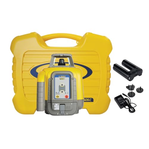
Checking an endpoint away from the transmitter gives connected control a purpose. The LL1505C supports remote functions and a documented manual-slope workflow. It is most relevant as a deliberately assembled system, with a compatible receiver and the required field supports selected separately.
The LL1505C provides automatic horizontal leveling and manual slope control. Its single-axis workflow slopes Y while X remains automatically leveled; the manually controlled axis is not automatically monitored for drift. Bluetooth control is built in, and the advanced Plane Match workflow requires an HL760; the selected BCC package does not identify a receiver, tripod, or rod. The selected BCC package leaves the receiver separate, and advanced Plane Match needs an appropriate HL760 arrangement. Its manually sloped axis also requires watching for change rather than assuming automatic grade monitoring. Choose it for the specific workflow, with a clear distinction between connected control and numerical grade setting.
Pros
- Automatic horizontal leveling.
- Documented single-axis slope workflow.
- Bluetooth app operation.
- Alternative alkaline operation.
- Height-of-instrument alert.
Cons
- Receiver and field support are separate in this package.
- Manual slope is not numerical grade entry.
The LL1505C makes sense for someone assembling a connected system around its documented manual-slope method, with a suitable receiver chosen separately. Bluetooth is useful when it lets the operator control the reference from a better checking position; it does not add automatic monitoring to a manual axis. A complete kit is a more direct starting point if those missing accessories have not been planned. With the workflow and components understood, the Spectra offers connected control for a specific measuring routine rather than connectivity for its own sake.
To buy this product, click here.
Choosing the Best Laser Level for Landscaping
Map Features to One Datum
Existing thresholds, paths, terraces, and beds can require different finished heights. Record those relationships before transferring marks. A common reference makes the differences measurable without making every surface level. Begin with checking the intended elevation changes across the site, using the actual plan rather than asking the laser to choose the drainage result.
Choose the Measurement Method
Keep a horizontal plane and calculate offsets, or use a documented slope workflow. Decide how each planned elevation will be verified. The instrument does not determine the drainage design.
Plan Receiver Sightlines
Shrubs, stored materials, and terrain can block the signal. Position the transmitter for clear paths to the actual stations. Preserve a transfer reference before moving the tripod.
Keep Rod Units and Contact Points Consistent
Use one graduation system and identify what the rod touches at each station. A reading on loose material is not interchangeable with a reading on a stable existing surface.
Recheck Through the Project
Excavation and preparation can disturb both ground and support. Return to the benchmark after interruptions or alerts. A self-leveling instrument can establish a new level plane at the wrong height after movement. The routine for keeping height transfers consistent outdoors helps when earthwork or equipment movement makes a new instrument position necessary.
FAQ
Can a Level Laser Help with a Sloping Landscape?
Yes. A horizontal datum can compare changing elevations through rod readings. The planned slopes and transitions still need to be established separately.
Does Landscaping Require Dual Slope?
No. Many measurements use a level reference and offsets. Dual slope is useful only when its specific workflow fits the intended surface.
Will the Laser Choose a Drainage Route?
No. It transfers or compares elevations. The intended route, outlet, and surface relationships must come from the landscape plan.
What If Plants Block the Receiver?
Choose a clearer setup position or reconnect through a preserved transfer mark. Do not assume a moved instrument retains the original datum.
Should I Measure Only the Corners?
Use the stations required by the actual plan and checking method. A few corner readings do not describe every intermediate high or low point.
Final Verdict
The Topcon RL-H5A leads for a garden layout organized around repeated outdoor height comparisons. Its focused reference can relate different intended elevations without asking every path, bed, and terrace to share one finished plane. The LL300N offers useful numeric receiver feedback; the GRL900-20HVK and Johnson system make a stronger starting point when complete field equipment is needed.
Slope and connected controls should follow the measurement method. They are useful when a defined task needs them, not simply because the ground changes height. Record the relationships to existing surfaces, preserve a benchmark outside the disturbed area, and keep the rod convention consistent. That turns the instrument into a way to carry the landscape plan through changing site conditions instead of a bright reference with an unclear purpose.
